
Why do we always have to vote the dumbest possible way in these things?
"UN vote on whether we should eat glass: 99% against, US stands alone as In Favor ."
This is for strictly mildly interesting material. If it's too interesting, it doesn't belong. If it's not interesting, it doesn't belong.
This is obviously an objective criteria, so the mods are always right. Or maybe mildly right? Ahh.. what do we know?
Just post some stuff and don't spam.
Why do we always have to vote the dumbest possible way in these things?
"UN vote on whether we should eat glass: 99% against, US stands alone as In Favor ."
Where can one find a good (pretty) interactive web map with this?
EDIT: Apparently it's from equal-earth.com 2018 but it got hugged to death
Dumbass United Stat...
Americans are probably the dumbest people on the planet.
Source: been here my whole life
NOT TRUE. there's those stupid short folk on the falklands with the webbed feet and the orange noses, what smell awful and like bad fish who dress formal everywhere. they're pretty silly
you must be kidding

Lmao the fucking irony:
The US, which voted against the resolution, slammed the text as an ideological exercise that it said undermined the UN’s credibility.
“This initiative is presented as an anodyne effort to update cartographic proportions,” said Mike Waltz, the US ambassador to the UN. “The United States clearly sees it cannot be separated from the much larger and more radical ideological project it belongs to.”
Wow, the US government is so paranoid, because how the fuck in your right mind can you find a reason to think “everyone’s out to get me” because others want to edit a map? It’s also funny how they never specify what this “radical ideology” is, despite constantly complaining about it like a child would about their mother not getting them an ice cream.
Not even Israel voted with the US this time. Take this opportunity for reflection.
It's because they don't want the world to see it getting bigger as it starts annexing its neighbors' land.
And of course, nobody is surprised.
I'm more surprised that Russia voted Yes
Russia doesn't care because they're big as fuck on any projection.
So is the US, but we voted no because we're contrarian little pissbabies.
Russia's been cozying up to Africa for a long time. And it was the AU which spearheaded this initiative.
This might be the first time in history Israel voted differently than the United States of America
Guess they will soon not only have their own system of measuring distance, weight and temperature; but also their own system of displaying Earth. They want to live in their own version of reality i guess.
I hope they make the map of USA really small and Canada and Mexico really big.
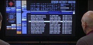
Why does the UN use LCARS?
Fuck all those who abstained and voted against
Mercator is bad as a world map, but the reason why it's used on most online maps is that those online maps are usually used as local maps, where Mercator is a very good projection. It would be good if online maps switched projections if you zoomed out beyond a certain level.
Not on iOS anymore but when you zoomed out on Apple Maps it became a globe. Not sure if that's still true or I remember incorrectly and am confused with a 3rd party map, but that would be best on screens imo.
Just checked. Apple Maps still zooms out into the globe on iOS
Nice, i didn't like Apple Maps for navigation but i did really appreciate the design of things. They had 3d maps quite early in the city I live in and I really liked that too. Props to Apple for that.
The Mercator map, which has been in common use since the 16th Century, has come in for criticism as it shows Africa as similar in size to Greenland, even though it is 14 times larger.
Critics say this leads to the development needs and potential for countries near the equator to be minimised.
I think that’s got more to do with the systemic legacy of colonialism than with which world maps people look at.
It’s both/and.


Let’s say you’re trying to convince a populace of an unpopular war to invade, I dunno, Greenland. You want to convince the country of its massive land & untapped riches.
Which map would you use?
but look at how large Australia looks in the second, maybe that is an alternative place to look to invade - and they have rearearth minerals
You'd have to defeat the native emu population, though. Good luck with that
Does it matter what projection the UN uses? Of course the actual UN logo is a wacky projection.
It's such a tragedy that the Earth had to be a sphere. I mean, I know it was inevitable. But come on, universe. A sphere? Really? You had to have known about Gauss's Theorema Egregium, yet you chose sphere. Now we're all fighting over who gets to be squished or enlarged and in what directions.
Oh, yeah, well Donald signed a new order changing every country’s name to America.
From now on all adresses: America [house number], America, America, America.
all house numbers are 1776
That's a very Aladeen news.