
"Ontario" is an indigenous word that was adopted by European colonists before either Canada or the US existed. Historical erasure from the "but muh statues" crowd.
this post was submitted on 02 Sep 2026
175 points (97.8% liked)
Technology
87956 readers
3859 users here now
This is a most excellent place for technology news and articles.
Our Rules
- Follow the lemmy.world rules.
- Only tech related news or articles.
- Be excellent to each other!
- Mod approved content bots can post up to 10 articles per day.
- Threads asking for personal tech support may be deleted.
- Politics threads may be removed.
- No memes allowed as posts, OK to post as comments.
- Only approved bots from the list below, this includes using AI responses and summaries. To ask if your bot can be added please contact a mod.
- Check for duplicates before posting, duplicates may be removed
- Accounts 7 days and younger will have their posts automatically removed.
Approved Bots
founded 3 years ago
MODERATORS
Disgusting.
Did the golden bribe from Tim Apple not tell you what side of the fascist kleptocracy Apple chose?
We live in an age of options.
Switch to the MapQuest app. It is literally the easiest thing you'll do today.
I am looking forward to Comaps (!comaps@sopuli.xyz) supporting public transport (which they are working on). I now just use the local service's app, which uses Apple Maps.
No public transport support, at least in the UK :(
I'm currently switching between a Google Maps webview wrapper which has gotten particularly buggy recently, and CityMapper which has unblockable ads and only really works inside cities, not commuting in/out/between them.
I'm desperately looking for a good alternative
I can't understand why anybody uses these products.
Okay, I can, it's marketing and ease of access. I guess it just annoys me that people don't care.
Deleted.
Just a note that Apple recently added ads to Apple Maps, so when you browse with it you’re giving them money and rewarding this.
MapQuest is not perfect but definitely usable
Such a monumental and pointless fuckup.
something something ask me literally anything about using or contributing to OpenStreetMap or about what it is/the state of it. get hyperspecific; see if I give a fuck.
Source: reasonably long-time user and contributor
I did a bunch around me with street complete until it started asking the width of the roads. Is that actually useful?
I started filling in all the house names because nothing here is numbered. It hasn't improved delivery drivers finding us 🤣
As someone who has worked in the geospatial industry, yeah, width of roads is useful eventually. But probably only for land development or simply understanding what a road is.
In the UK it's common for country lanes to have a speed limit of 60 MPH, while only being metres (9 ft) wide. Including road widths is useful for some routing engines for both normal cars, and HGVs.
I have been adding businesses in OSM for awhile, but refrained from doing any roads.. until a few days ago! It is actually very easy haha.
How should we approach businesses that closed and another opened in the same building? Should we delete and add another, or should we edit and change the name? Does osm keep records of what was in there before, for hisotrical reasons?
OpenHistoricalMap tracks that sort of thing. OpenStreetMap is strictly for what's currently (and at least semi-permanently) there. For businesses that just closed, it's a good idea to put a note saying something like "Formerly Dairy Emporium" (along with potentially, say, when it closed if known). This not only potentially helps confused users, but it also helps other contributors who might try to "correct" what seems like a mistake.
Editing and changing the info is ideal, because it preserves the edit history. A deleted object is a lot harder to find the edit history of.
Thanks. Just to better understand it, does older data from osm automatically go to openhistoricalmap, or is it a completely separate project which its own contributors?
I see. Feels like a missed opportunity on osm to be able to press a point and look for what used to be there
Personally, I think it's for the better they remain separate projects for logistical reasons. I also understand why OHM went with CC0 for their license, and it was their (I think correct) choice to make it incompatible with the OSM one.
I know that's vague, but mainly, I think OHM is better off not having to worry about OSM shenanigans, while OSM is better off being able not to have to worry about historic preservation.
It could be as simple as keeping the edit history and allowing to rollback to a date. I don't see the point in not preserving the data
Could we rename the white house to something like brown diaper house as a protest through osm?
We'd ask that you didn't try. Directing your energy toward improving OSM in your area and moving people away from the corporations kowtowing to Trump and other fascists is what makes an actual difference.
Fair :p
If this news comes as a surprise to you, you're part of the problem.
Good thing I switched to Mapy long ago... still hurts as an Apple user though.
Not Yet.
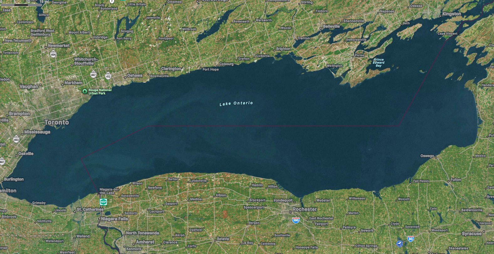
Still Lake Ontario for me too.

I'm not American should I give a fuck about this?
Idk what does apple maps say in your country?
It says "Lake Ontario (Lake America)".
I guess not.
Why the hell would I get my geographical information from Apple?
Fuck if I know. I didn't know they had a maps thingy before this